Target
Asset reference
Concept
A target is a geographic point of interest — a city, site, or landmark — used when you care about access to a place without modeling a full ground station RF chain.
Use targets for simple visibility/access studies, as Link secondaries among platforms, or as aiming points for sensor Targeted pointing. Prefer a Facility when you need elevation masks, antennas, and ground COMM parameters.
Parameters
| Parameter | Type | Default | Notes |
|---|---|---|---|
| Cities database | select | — | Preset fills name + geodetic |
| Name | text | — | |
| Active | checkbox | — | |
| Latitude [deg] | decimal | 40.4168 |
|
| Longitude [deg] | decimal | -3.7038 |
|
| Altitude [m] | decimal | 667 |
Note: default differs slightly from facility |
| Footprint radius [m] | decimal | 100 |
Visualization |
| Color | color | #FFA500 |
Example
Create Athens, then use it as a Link Analysis secondary or Coverage-related site.
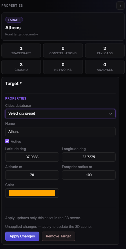
Target Properties — Athens point (name and geodetic coordinates).