Facility
Asset reference
Concept
A facility is a fixed ground station: a geodetic site that sees the sky above a minimum elevation, may host antennas and receivers, and often terminates downlinks in link, network, or latency studies.
Facilities are the usual “ground end” of space–ground access. Database presets speed up realistic siting; COMM fields describe buffer and rate limits for data-flow style analyses; constraints (especially ground elevation and range) shape when contacts are valid.
When to use
| Use a facility when… | Prefer a target when… |
|---|---|
| You model a ground station with RF / elevation masks | You only need a geographic point without COMM buffers |
| Link, Connection Network, or Latency terminates on ground | The point is a surveillance / imaging aim point only |
Parameters
Identity & position
| Parameter | Type | Default | Notes |
|---|---|---|---|
| Facility database | select | — | Preset applies name + lat/lon/alt |
| Name | text | — | |
| Active | checkbox | — | |
| Latitude [deg] | decimal | 40.4168 |
|
| Longitude [deg] | decimal | -3.7038 |
|
| Altitude [m] | decimal | 650 |
|
| Footprint radius [m] | decimal | 100 |
Web visualization helper |
| Color | color | #FFA500 |
|
| Model scale | decimal | 1 |
|
| 3D model path | text | optional |
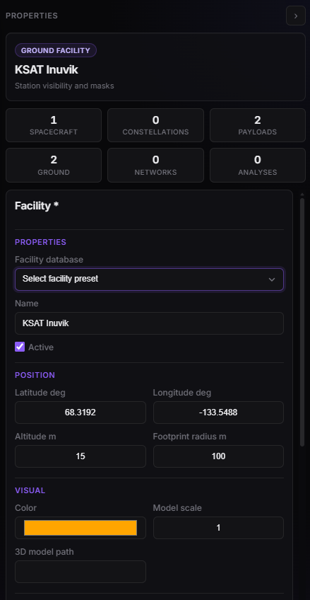
Facility Properties — database preset, geodetic site, model.
COMM and constraints
COMM is the ground half of a Latency hop. How the spacecraft bus fields map into Latency is on Spacecraft — COMM.
| Parameter | Kind | Default |
|---|---|---|
| Downlink max RX rate | data rate | 450 Mbps |
| Uplink max RX rate | data rate | 5 Mbps |
| Ground buffer capacity | data size | 50 GB |
| Max concurrent links | count | 1 |
| Processing latency | time | 1 s |
Constraints use the same catalogue as spacecraft (Range, Ground elevation, Eclipse, …). Add constraint starts from a Range 0–2000 km template; you can change type and Remove. On Web the facility cards do not expose Enabled or numeric parameters (those editors are on spacecraft / vehicle).
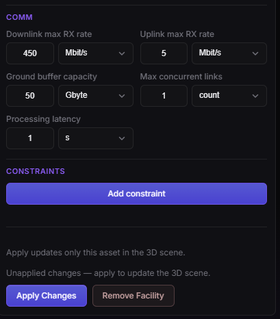
Facility Properties — COMM (ingest rates, ground buffer, processing).
Allowed children
sensor · antenna · transmitter · receiver · solar_array
Example
- Pick a database station or set lat/lon near your AOI.
- Add a receiver (+ antenna if Complex RF).
- Use the facility as Link secondary or Connection Network endpoint.